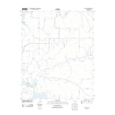
2012 Map of Salina SE
USGS Topo · Published 2012About this map
Ross Mayes Cem and the small community of Hoot Owl stand among a landscape defined by its creek systems and artificial reservoirs in this 2012 study of Mayes County. The topography is anchored by the Neosho River to the west and the expansive waters of Chimney Rock Lake to the south. These water bodies, along with Spavinaw Lake in the north, represent the significant hydroelectric and recreational infrastructure that has transformed the eastern Oklahoma terrain.
Find a feature on this map
48 named features on this map. Tap any name to fly to it.
Don’t see what you’re looking for? This feature index may not catch every label — zoom into the map to look around manually.
Map Details
Editions of this 2012 Salina SE Map
This is the sole edition of this map. No revisions or reprints were ever made.
Other maps of this area

1896 · Pryor
USGS Topo · 1:125,000

1899 · Siloam Springs
USGS Topo · 1:125,000

1901 · Pryor
USGS Topo · 1:125,000

1903 · Siloam Springs
USGS Topo · 1:125,000

1904 · Siloam Springs
USGS Topo · 1:125,000

1954 · Tulsa
USGS Topo · 1:250,000

1958 · Tulsa
USGS Topo · 1:250,000

1963 · Tulsa
USGS Topo · 1:250,000

1971 · Kenwood
USGS Topo · 1:24,000
1971 · Salina
USGS Topo · 1:24,000