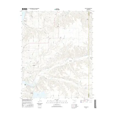
2016 Map of Salina SE
USGS Topo · Published 2016About this map
Wickliffe and Kenwood sit within a landscape defined by the winding drainages of the Ozark foothills, where Saline Cr and its tributaries carve deep through the plateau. This 2016 survey shows the transition from upland ridges to the water-managed lowlands of the Chimney Rock Reservoir and the northern reaches of Lake Hudson. The map preserves the locations of generational land markers, including the Ross Mayes Cem and Grass Cem, which provide essential touchpoints for family historians in this corner of Mayes County.
Find a feature on this map
56 named features on this map. Tap any name to fly to it.
Don’t see what you’re looking for? This feature index may not catch every label — zoom into the map to look around manually.
Map Details
Editions of this 2016 Salina SE Map
This is the sole edition of this map. No revisions or reprints were ever made.
Other maps of this area

1896 · Pryor
USGS Topo · 1:125,000

1899 · Siloam Springs
USGS Topo · 1:125,000

1901 · Pryor
USGS Topo · 1:125,000

1903 · Siloam Springs
USGS Topo · 1:125,000

1904 · Siloam Springs
USGS Topo · 1:125,000

1954 · Tulsa
USGS Topo · 1:250,000

1958 · Tulsa
USGS Topo · 1:250,000

1963 · Tulsa
USGS Topo · 1:250,000

1971 · Kenwood
USGS Topo · 1:24,000
1971 · Salina
USGS Topo · 1:24,000