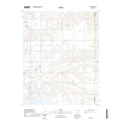
2019 Map of Salina SE
USGS Topo · Published 2019About this map
The small settlement of Hoot Owl anchors the northern reaches of this rural Oklahoma landscape, which is defined by a intricate system of creek valleys and ridges. This topography is dominated by the winding paths of Saline Creek and the Little Saline Creek, which carve deep through the terrain of Mayes and Delaware counties. The map captures the distinct rural development pattern of the region, where homes and farmsteads are concentrated along high ground, leaving the densely wooded slopes of Chicken Hollow and Wickliffe Creek largely untouched. Of particular interest to local historians are the established rural burial grounds, including the Wickliffe Cemetery, Grass Cemetery, and Ross Hayes Cemetery, which stand alongside long-standing local landmarks like Chimney Rock Hollow and the Pump Back area.
Find a feature on this map
1 named feature on this map. Tap any name to fly to it.
Don’t see what you’re looking for? This feature index may not catch every label — zoom into the map to look around manually.
Map Details
Editions of this 2019 Salina SE Map
This is the sole edition of this map. No revisions or reprints were ever made.
Other maps of this area

1896 · Pryor
USGS Topo · 1:125,000

1899 · Siloam Springs
USGS Topo · 1:125,000

1901 · Pryor
USGS Topo · 1:125,000

1903 · Siloam Springs
USGS Topo · 1:125,000

1904 · Siloam Springs
USGS Topo · 1:125,000

1954 · Tulsa
USGS Topo · 1:250,000

1958 · Tulsa
USGS Topo · 1:250,000

1963 · Tulsa
USGS Topo · 1:250,000

1971 · Kenwood
USGS Topo · 1:24,000
1971 · Salina
USGS Topo · 1:24,000