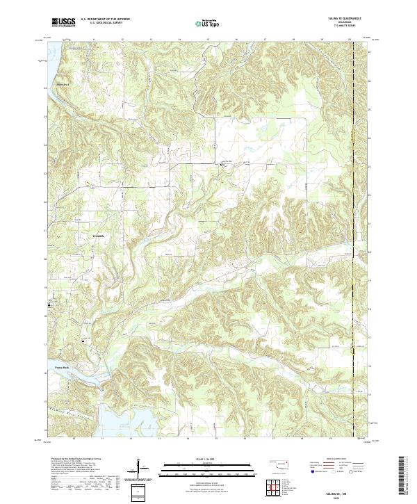
2022 Map of Salina SE
USGS Topo · Published 2022About this map
The Neosho River and Chimney Rock Lake anchor the landscape of this Mayes County region, which is marked by the rugged drainage patterns of Saline Cr and its tributaries. The settlement of Wickliffe serves as a central point for local researchers, who will find several family and community burial sites such as Wickliffe Cem, Ross Mayes Cem, and Grass Cem nearby. The terrain is defined by deep incisions like Chicken Hollow and Chimney Rock Hollow, which illustrate the complex topography east of the river. Small settlements like Hoot Owl and Pump Back are situated along a network of county roads, including Indian Springs Rd and Kenwood Rd, providing a detailed look at the rural infrastructure and land use in this part of northeastern Oklahoma.
Find a feature on this map
63 named features on this map. Tap any name to fly to it.
Don’t see what you’re looking for? This feature index may not catch every label — zoom into the map to look around manually.
Map Details
Editions of this 2022 Salina SE Map
This is the sole edition of this map. No revisions or reprints were ever made.
Other maps of this area

1896 · Pryor
USGS Topo · 1:125,000

1899 · Siloam Springs
USGS Topo · 1:125,000

1901 · Pryor
USGS Topo · 1:125,000

1903 · Siloam Springs
USGS Topo · 1:125,000

1904 · Siloam Springs
USGS Topo · 1:125,000

1954 · Tulsa
USGS Topo · 1:250,000

1958 · Tulsa
USGS Topo · 1:250,000

1963 · Tulsa
USGS Topo · 1:250,000

1971 · Kenwood
USGS Topo · 1:24,000
1971 · Salina
USGS Topo · 1:24,000