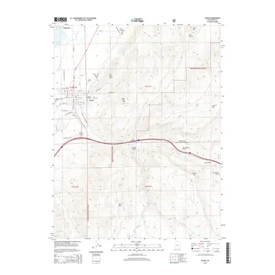
2014 Map of Salina
USGS Topo · Published 2014About this map
Salina and Redmond sit at the western edge of a landscape defined by the transition from the Sevier River valley to the high, varied terrain of the Fishlake National Forest. The map documents a complex irrigation and water management system, including the W View Canal, Trunk Ditch, and Redmond Lake. Local heritage is anchored by three distinct burial grounds: the Salina City Cem, the historic Pioneer Cem, and the E Side Cem, providing a clear footprint of the area's genealogical history. To the east, the geography becomes more severe, marked by Trunk Canyon, Twist Canyon, and several prominent peaks such as Black Cap Mtn and Triangle Mtn. The presence of The Stone Quarry north of Salina points to the area's extractive history, while the sprawling forest boundaries highlight the intersection of settlement and public lands.
Find a feature on this map
70 named features on this map. Tap any name to fly to it.
Don’t see what you’re looking for? This feature index may not catch every label — zoom into the map to look around manually.
Map Details
Editions of this 2014 Salina Map
This is the sole edition of this map. No revisions or reprints were ever made.
Other maps of this area

1885 · Manti
USGS Topo · 1:250,000

1885 · Fish Lake
USGS Topo · 1:250,000

1895 · Manti
USGS Topo · 1:250,000

1896 · Fish Lake
USGS Topo · 1:250,000

1956 · Salina
USGS Topo · 1:250,000

1956 · Price
USGS Topo · 1:250,000

1960 · Price
USGS Topo · 1:250,000

1960 · Salina
USGS Topo · 1:250,000

1962 · Salina
USGS Topo · 1:250,000

1962 · Price
USGS Topo · 1:250,000