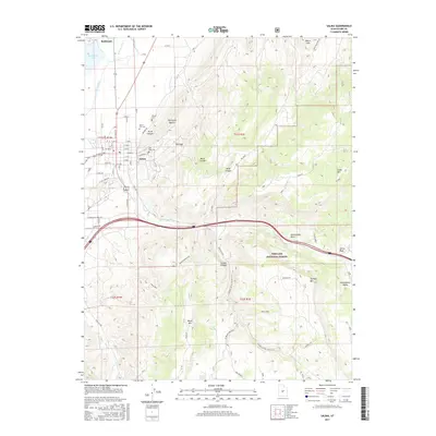
2017 Map of Salina
USGS Topo · Published 2017About this map
The Sevier River and its accompanying W View Canal shape the agricultural and settlement patterns of this Sevier County corridor. In the early 21st century, Salina serves as the central hub, its residential grid anchored by the historic Pioneer Cem and Salina City Cem. The town's industrial legacy is visible at The Stone Quarry near Trunk Canyon, while the surrounding terrain transitions into the high elevations of the Fishlake National Forest.
Find a feature on this map
66 named features on this map. Tap any name to fly to it.
Don’t see what you’re looking for? This feature index may not catch every label — zoom into the map to look around manually.
Map Details
Editions of this 2017 Salina Map
This is the sole edition of this map. No revisions or reprints were ever made.
Other maps of this area

1885 · Manti
USGS Topo · 1:250,000

1885 · Fish Lake
USGS Topo · 1:250,000

1895 · Manti
USGS Topo · 1:250,000

1896 · Fish Lake
USGS Topo · 1:250,000

1956 · Salina
USGS Topo · 1:250,000

1956 · Price
USGS Topo · 1:250,000

1960 · Price
USGS Topo · 1:250,000

1960 · Salina
USGS Topo · 1:250,000

1962 · Salina
USGS Topo · 1:250,000

1962 · Price
USGS Topo · 1:250,000