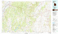
1980 Map of Salina
USGS Topo · Published 1981About this map
The Sevier Plateau and Fish Lake Plateau dominate this 1980 survey, illustrating a landscape defined by high-elevation water management and early transportation corridors. The Denver and Rio Grande Western RR follows the Sevier River valley through settlements like Salina and Sigurd, while the newly developed Interstate 70 carves a path eastward across the Old Woman Plateau. This era shows the critical role of reservoirs such as Lost Creek Reservoir and Mill Meadow Reservoir in supporting the valley's agricultural communities.
Find a feature on this map
52 named features on this map. Tap any name to fly to it.
Don’t see what you’re looking for? This feature index may not catch every label — zoom into the map to look around manually.
Map Details
Editions of this 1980 Salina Map
2 editions found
Other maps of this area

1885 · San Rafael
USGS Topo · 1:250,000

1885 · Manti
USGS Topo · 1:250,000

1885 · Beaver
USGS Topo · 1:250,000

1885 · Sevier Desert
USGS Topo · 1:250,000

1885 · Fish Lake
USGS Topo · 1:250,000

1886 · Price River
USGS Topo · 1:250,000

1895 · Manti
USGS Topo · 1:250,000

1896 · Price River
USGS Topo · 1:250,000

1896 · Fish Lake
USGS Topo · 1:250,000

1922 · Emery No.3
USGS Topo · 1:31,680