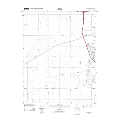
2012 Map of Salina SW
USGS Topo · Published 2012About this map
Salina Municipal Airport and the expanding infrastructure of southwestern Saline County define this 2012 landscape. The area serves as a major regional educational and transit hub, anchored by Kansas State Univ At Salina and the Salina Area Technical Coll. While much of the territory remains open agricultural land drained by Mulberry Cr and Spring Cr, the eastern edge shows the structured growth of the city’s residential and institutional corridors. Notable recreational and utility features, such as the Salina Speedway and Camp Win E Mar, are situated alongside essential municipal services like the Salina Municipal Solid Waste Landfill. The road network is particularly dense here, where modern thoroughfares meet historical routes like Old US Hwy 40.
Find a feature on this map
87 named features on this map. Tap any name to fly to it.
Don’t see what you’re looking for? This feature index may not catch every label — zoom into the map to look around manually.
Map Details
Editions of this 2012 Salina SW Map
This is the sole edition of this map. No revisions or reprints were ever made.
Other maps of this area

1892 · Salina
USGS Topo · 1:125,000

1942 · Salina
USGS Topo · 1:125,000

1955 · Salina
USGS Topo · 1:24,000

1955 · Assaria
USGS Topo · 1:24,000

1955 · Salina SW
USGS Topo · 1:24,000

1955 · Trenton
USGS Topo · 1:24,000

1955 · Smolan
USGS Topo · 1:24,000

1955 · Brookville
USGS Topo · 1:24,000

1955 · Culver
USGS Topo · 1:24,000

1955 · New Cambria
USGS Topo · 1:24,000