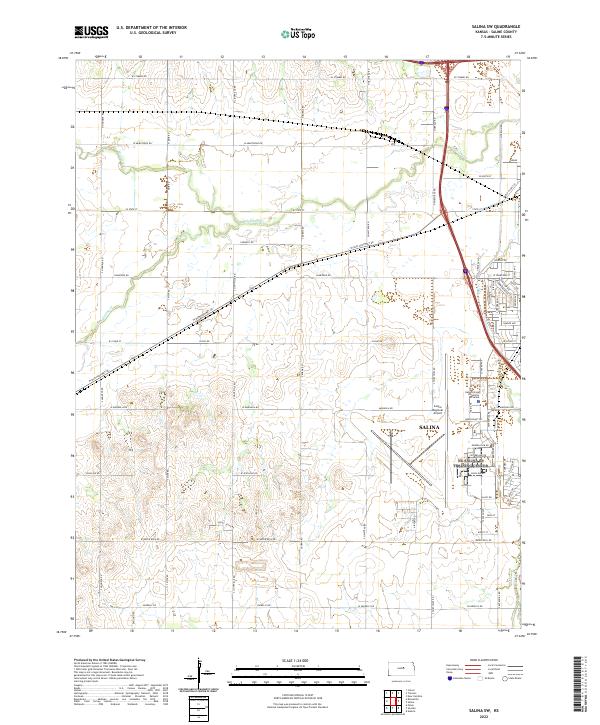
2022 Map of Salina SW
USGS Topo · Published 2022About this map
The western edges of Salina and the expansive infrastructure of the Salina Regional Airport define this prairie landscape in Saline County. The map illustrates a significant institutional presence with the Kansas State University at Salina campus positioned near the airfield, showing the intersection of education and regional transit. This area serves as a critical transportation hub where modern interstate routes meet historic corridors like W Old US Hwy 40 and W Old Highway 40. Beyond the developed municipal boundaries, the land transitions into a grid of section-line roads, such as N Lightville Rd and S Burma Rd, that carve through the agricultural terrain. Small waterways including Mulberry Cr and Spring Cr meander across the plains, following the natural drainage patterns of the region south and west of the city center.
Find a feature on this map
76 named features on this map. Tap any name to fly to it.
Don’t see what you’re looking for? This feature index may not catch every label — zoom into the map to look around manually.
Map Details
Editions of this 2022 Salina SW Map
This is the sole edition of this map. No revisions or reprints were ever made.
Other maps of this area

1892 · Salina
USGS Topo · 1:125,000

1942 · Salina
USGS Topo · 1:125,000

1955 · Salina
USGS Topo · 1:24,000

1955 · Assaria
USGS Topo · 1:24,000

1955 · Salina SW
USGS Topo · 1:24,000

1955 · Trenton
USGS Topo · 1:24,000

1955 · Smolan
USGS Topo · 1:24,000

1955 · Brookville
USGS Topo · 1:24,000

1955 · Culver
USGS Topo · 1:24,000

1955 · New Cambria
USGS Topo · 1:24,000