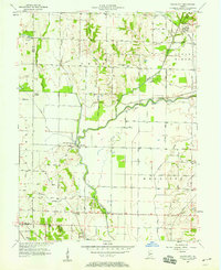
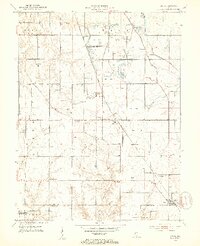
1957 Map of Saline City
USGS Topo · Published 1958About this map
Eel River winds through this Clay County landscape, defining the topography near settlements like Saline City and Old Hill. The mid-century map illustrates a rural economy shifting between traditional agriculture and heavy industry, evidenced by the extensive Strip Mine operations and the presence of the Monon and C M St P & P railroads. For genealogists, the map is a vital resource for locating rural landmarks like Zion-Gummere Cem and Stagg Cem, alongside community centers such as Zion Ch and Briley Chapel. The terrain is marked by notable drainage features like Conneley Ditch and Lafferty Ditch, which reflect the managed water systems of the Indiana bottomlands. The map also captures the distinct elevation of Sugar Ridge and the remote Hickory Island in the west.
Find a feature on this map
34 named features on this map. Tap any name to fly to it.
Don’t see what you’re looking for? This feature index may not catch every label — zoom into the map to look around manually.
Map Details
Editions of this 1957 Saline City Map
4 editions found
Other maps of this area

1908 · Clay City
USGS Topo · 1:48,000

1910 · Clay City
USGS Topo · 1:62,500

1938 · Coal City
USGS Topo · 1:24,000

1940 · Lewis
USGS Topo · 1:24,000

1940 · Jasonville
USGS Topo · 1:24,000

1941 · Seelyville
USGS Topo · 1:24,000

1943 · Hymera
USGS Topo · 1:24,000

1948 · Coal City
USGS Topo · 1:24,000
1952 · Lewis
USGS Topo · 1:24,000

1952 · Seelyville
USGS Topo · 1:24,000