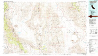
1985 Map of Saline Valley
USGS Topo · Published 1985About this map
Death Valley National Monument dominates the eastern half of this 1980s landscape, where the Panamint Range separates the iconic sinks of Death Valley from the Saline Valley to the west. This period of mapping shows a high concentration of mining claims across the Inyo Mountains and the Nelson Range, including the historically significant Cerro Gordo Mine and Lippincott Mine. These sites speak to the era's enduring mineral interest, while the remote outpost at Stovepipe Wells serves as a primary point of human activity near the Sand Dunes.
Find a feature on this map
68 named features on this map. Tap any name to fly to it.
Don’t see what you’re looking for? This feature index may not catch every label — zoom into the map to look around manually.
Map Details
Editions of this 1985 Saline Valley Map
2 editions found
Other maps of this area

1905 · Olancha
USGS Topo · 1:125,000

1907 · Olancha
USGS Topo · 1:125,000

1907 · Mt. Whitney
USGS Topo · 1:125,000

1908 · Kawich
USGS Topo · 1:250,000

1908 · Lida
USGS Topo · 1:250,000

1908 · Furnace Creek
USGS Topo · 1:250,000

1908 · Ballarat
USGS Topo · 1:250,000

1910 · Furnace Creek
USGS Topo · 1:250,000

1913 · Bishop
USGS Topo · 1:125,000

1913 · Lida
USGS Topo · 1:250,000