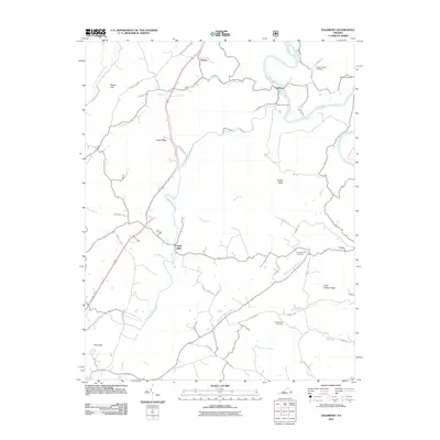
2011 Map of Salisbury
USGS Topo · Published 2011About this map
Salisbury Furnace stands as a significant industrial landmark along the James River in this part of Botetourt County. The landscape is defined by the prominent heights of Cedar Ridge and Timber Ridge, which guide the path of Catawba Creek through the central valley. Small settlements such as Owens, Poplar Hill, and Kyles Mills are connected by a network of rural roads that trace the undulating terrain and various watercourses like Lapsley Run and Beaverdam Creek.
Find a feature on this map
45 named features on this map. Tap any name to fly to it.
Don’t see what you’re looking for? This feature index may not catch every label — zoom into the map to look around manually.
Map Details
Editions of this 2011 Salisbury Map
This is the sole edition of this map. No revisions or reprints were ever made.
Other maps of this area

1890 · Roanoke
USGS Topo · 1:125,000

1891 · Roanoke
USGS Topo · 1:125,000

1894 · Natural Bridge
USGS Topo · 1:125,000

1894 · Natural Bridge
USGS Topo · 1:62,500

1907 · Natural Bridge Special
USGS Topo · 1:62,500

1913 · Eagle Rock
USGS Topo · 1:48,000

1915 · Eagle Rock
USGS Topo · 1:62,500

1929 · Roanoke
USGS Topo · 1:48,000

1933 · Roanoke
USGS Topo · 1:62,500

1947 · Roanoke
USGS Topo · 1:250,000