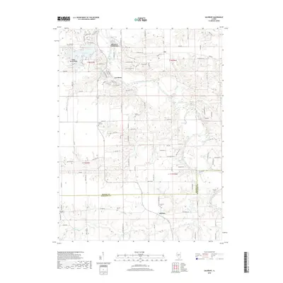
2018 Map of Salisbury
USGS Topo · Published 2018About this map
Salisbury and the surrounding prairie and river bluffs define this section of the Central Illinois landscape where the Sangamon River meanders across the border of Menard and Sangamon counties. In the northern reaches of the map, the planned community surrounding Lake Petersburg contrasts with the older settlement patterns of Tice and Lewisburg. The map reveals a high density of family and community burial grounds, such as Harrison Cem and Hickory Grove Cem, reflecting the deep agricultural roots of the area. This 2018 survey also highlights the cultural footprint of Old Salem Chautauqua, a site with roots in the late 19th-century educational movement. The network of rural roads, including Taylor Homestead Rd and Irwin Bridge Rd, follows the section lines of the Public Land Survey System, while watercourses like Richland Cr and Prairie Cr carve subtle valleys through the productive farmland.
Find a feature on this map
102 named features on this map. Tap any name to fly to it.
Don’t see what you’re looking for? This feature index may not catch every label — zoom into the map to look around manually.
Map Details
Editions of this 2018 Salisbury Map
This is the sole edition of this map. No revisions or reprints were ever made.
Other maps of this area

1907 · Springfield
USGS Topo · 1:62,500

1909 · Tallula
USGS Topo · 1:62,500

1930 · Springfield
USGS Topo · 1:62,500

1933 · Petersburg
USGS Topo · 1:62,500

1938 · Petersburg
USGS Topo · 1:62,500

1940 · Tallula
USGS Topo · 1:62,500

1940 · Springfield
USGS Topo · 1:62,500

1948 · Mason City
USGS Topo · 1:62,500

1949 · Mason City
USGS Topo · 1:62,500

1950 · Springfield West
USGS Topo · 1:24,000