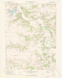
1970 Map of Salisbury
USGS Topo · Published 1973About this map
Lincolns New Salem State Park preserves the frontier history of the area along the Sangamon River, including the Old Grist Mill near Lewisburg. This 1970s record shows the landscape at a point of modernization, where the established town of Salisbury and the settlement at Tice sit alongside newer developments like Lake Petersburg and several specialized facilities including Sunny Acres Nursing Home. The map serves as a vital genealogical resource, documenting numerous rural burying grounds such as Hickory Grove Cem, Farmers Point Cem, and Harrison Cem. The path of the Chicago and Illinois Midland railroad cuts through the northern sections, while Richland Ch and Richland Creek mark the southern border where Menard and Sangamon Counties meet.
Find a feature on this map
31 named features on this map. Tap any name to fly to it.
Don’t see what you’re looking for? This feature index may not catch every label — zoom into the map to look around manually.
Map Details
Editions of this 1970 Salisbury Map
2 editions found
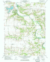
Other maps of this area

1907 · Springfield
USGS Topo · 1:62,500

1909 · Tallula
USGS Topo · 1:62,500

1930 · Springfield
USGS Topo · 1:62,500

1933 · Petersburg
USGS Topo · 1:62,500

1938 · Petersburg
USGS Topo · 1:62,500

1940 · Tallula
USGS Topo · 1:62,500

1940 · Springfield
USGS Topo · 1:62,500

1948 · Mason City
USGS Topo · 1:62,500

1949 · Mason City
USGS Topo · 1:62,500

1950 · Springfield West
USGS Topo · 1:24,000