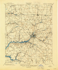
1901 Map of Salisbury
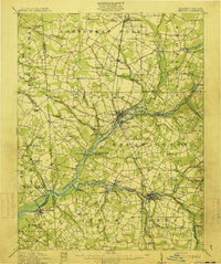
USGS Topo · Published 1945About this map
Salisbury sits at the convergence of three distinct rail lines at the turn of the century, serving as the commercial and industrial hub for the lower Eastern Shore. The Pennsylvania R. R. and the New York Philadelphia and Norfolk R. R. run north-south through the center of town, meeting the east-west Baltimore Chesapeake and Atlantic R. R.. This complex rail network is complemented by the deep waters of the Wicomico River, where Shad Pt. and Sharps Pt. mark the channel’s winding path toward the Upper Ferry. Beyond the urban core of Camden and Frankford, the landscape is defined by tidal creeks and numerous mill ponds such as Leonard Pond, Nailors Pond, and Morris Pond. These water bodies and the surrounding election districts, like Barren Creek and Nutters, reveal a rural economy transitionally linked to the shipping ports and growing rail-side settlements of Hebron and Delmar along the Delaware Maryland boundary.
Find a feature on this map
79 named features on this map. Tap any name to fly to it.
Don’t see what you’re looking for? This feature index may not catch every label — zoom into the map to look around manually.
Map Details
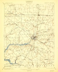
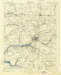
Editions of this 1901 Salisbury Map
4 editions found
Other maps of this area

1901 · Snow Hill
USGS Topo · 1:62,500

1901 · Salisbury
USGS Topo · 1:62,500

1902 · Pittsville
USGS Topo · 1:62,500

1903 · Nanticoke
USGS Topo · 1:62,500

1903 · Deal Island
USGS Topo · 1:62,500

1905 · Hurlock
USGS Topo · 1:62,500
1915 · Seaford
USGS Topo · 1:62,500

1917 · Millsboro
USGS Topo · 1:62,500

1938 · Millsboro
USGS Topo · 1:62,500

1942 · Monie
USGS Topo · 1:24,000