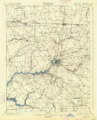
1901 Map of Salisbury
USGS Topo · Published 1934About this map
Salisbury serves as the bustling geographic and economic center of this Maryland Eastern Shore survey, where the convergence of rail lines and the Wicomico River dictated the region's development at the dawn of the 20th century. The landscape is defined by its intricate water systems, from the broad Wicomico River to smaller drainages like Rewastico Creek and Beaverdam Creek. The settlement pattern follows a clear industrial logic, with towns like Delmar straddling the Boundary Line between Delaware and Maryland, and Hebron positioned along the Baltimore and Chesapeake R. R.
Find a feature on this map
79 named features on this map. Tap any name to fly to it.
Don’t see what you’re looking for? This feature index may not catch every label — zoom into the map to look around manually.
Map Details
Editions of this 1901 Salisbury Map
4 editions found
Other maps of this area

1901 · Snow Hill
USGS Topo · 1:62,500

1901 · Salisbury
USGS Topo · 1:62,500

1902 · Pittsville
USGS Topo · 1:62,500

1903 · Nanticoke
USGS Topo · 1:62,500

1903 · Deal Island
USGS Topo · 1:62,500

1905 · Hurlock
USGS Topo · 1:62,500

1915 · Seaford
USGS Topo · 1:62,500

1917 · Millsboro
USGS Topo · 1:62,500

1938 · Millsboro
USGS Topo · 1:62,500

1942 · Monie
USGS Topo · 1:24,000