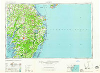
1961 Map of Salisbury
USGS Topo · Published 1961About this map
Salisbury stands as the primary hub of the Delmarva Peninsula in this early 1960s revision, which details the intricate relationship between the region's inland agricultural centers and its burgeoning coastal resorts. The map traces the varied geography from the marshy edges of Tangier Sound and Smith Island in the west to the popular Atlantic destinations of Rehoboth Beach and Ocean City. This era shows the peninsula's connectivity through a dense network of roads and rail lines serving towns like Seaford and Pocomoke City. Maritime infrastructure is particularly prominent, with essential navigation markers like the Cape May Lighthouse and the Fenwick Island Lighthouse guarding the approaches to Delaware Bay. The presence of the Fort Miles Military Reservation near Cape Henlopen and the Cape May Naval Air Station underscores the strategic coastal importance of the area during the Cold War years.
Find a feature on this map
182 named features on this map. Tap any name to fly to it.
Don’t see what you’re looking for? This feature index may not catch every label — zoom into the map to look around manually.
Map Details
Editions of this 1961 Salisbury Map
This is the sole edition of this map. No revisions or reprints were ever made.
Other maps of this area

1884 · Sea Isle
USGS Topo · 1:62,500

1888 · Cape May
USGS Topo · 1:62,500

1888 · Dennisville
USGS Topo · 1:62,500

1888 · Sea Isle
USGS Topo · 1:62,500

1890 · Maurice Cove
USGS Topo · 1:62,500

1891 · Maurice Cove
USGS Topo · 1:62,500

1893 · Cape May
USGS Topo · 1:62,500

1894 · Dennisville
USGS Topo · 1:62,500

1894 · Sea Isle
USGS Topo · 1:62,500

1898 · Choptank
USGS Topo · 1:125,000