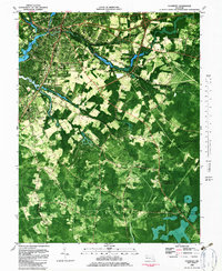
1982 Map of Salisbury
USGS Topo · Published 1983About this map
Salisbury and its surrounding wetlands are captured here during a period of significant educational and residential expansion in the early 1980s. The map illustrates the city’s complex relationship with its water systems, from the Wicomico River to localized bodies like Schumaker Pond and Morris Mill Pond. Educational institutions are prominent, including Salisbury State College, Parkside High Sch, and Wicomico High Sch, reflecting the regional importance of this hub.
Find a feature on this map
62 named features on this map. Tap any name to fly to it.
Don’t see what you’re looking for? This feature index may not catch every label — zoom into the map to look around manually.
Map Details
Editions of this 1982 Salisbury Map
2 editions found
Other maps of this area

1901 · Snow Hill
USGS Topo · 1:62,500

1901 · Salisbury
USGS Topo · 1:62,500

1902 · Pittsville
USGS Topo · 1:62,500

1942 · Princess Anne
USGS Topo · 1:24,000

1942 · Snow Hill
USGS Topo · 1:24,000

1942 · Eden
USGS Topo · 1:24,000

1942 · Wango
USGS Topo · 1:24,000

1942 · Hebron
USGS Topo · 1:24,000

1942 · Dividing Creek
USGS Topo · 1:24,000

1942 · Salisbury
USGS Topo · 1:24,000