
1955 Map of Salmon Mtn
USGS Topo · Published 1957About this map
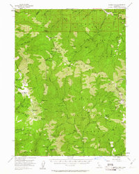
Klamath National Forest and Trinity National Forest dominate this rugged landscape, centering on the high peaks of the Salmon Mountains. During the early 1950s, this region remained a wilderness of deep canyons and isolated mining operations, connected largely by the Summit Trail and Horse Prairie Trail. The map records a dense network of historic gold and copper mining sites, including the Stanshaw Mine, Red Hill Mine, and Marysville (Site). These camps and sites, such as Old Denny, speak to a legacy of extraction along the Salmon River and its many tributaries like Knownothing Creek. The presence of the Trinity Summit Guard Station and several remote cabins, including Barton Cabin and Megram Cabin, suggests a landscape managed by foresters and inhabited by few, where high-altitude markers like Salmon Mtn and North Trinity Mountain served as the primary landmarks.
Find a feature on this map
99 named features on this map. Tap any name to fly to it.
Don’t see what you’re looking for? This feature index may not catch every label — zoom into the map to look around manually.
Map Details
Editions of this 1955 Salmon Mtn Map
3 editions found
Other maps of this area

1909 · Big Bar
USGS Topo · 1:96,000

1915 · Big Bar and Vicinity
USGS Topo · 1:250,000

1922 · China Flat
USGS Topo · 1:62,500

1925 · Hoopa
USGS Topo · 1:125,000

1948 · Weed
USGS Topo · 1:250,000

1950 · Weed
USGS Topo · 1:250,000

1951 · Helena
USGS Topo · 1:62,500

1951 · Ironside Mountain
USGS Topo · 1:62,500

1952 · Willow Creek
USGS Topo · 1:62,500

1952 · Hoopa
USGS Topo · 1:62,500