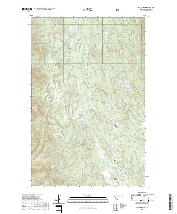
2024 Map of Salmon Prairie
USGS Topo · Published 2024About this map
Salmon Prairie sits along the banks of the Swan River in a valley defined by the steep slopes of the Mission Range to the west. This landscape, dominated by the Flathead National Forest, illustrates a classic Montana mountain-and-meadow drainage pattern where high-elevation creeks like South Woodward Creek and Lion Creek feed into broader wetlands and basins. The presence of Natural Cemeteries east of the river and several named clearings such as Squeezer Meadow and Simmons Meadow point to the area's history of small-scale settlement and grazing. Access is defined by a network of forest roads and trails, including Piper Lake Trl and Shay Lake Rd, which connect the scattered lakes like Dry Lake and Van Lake to the main thoroughfare of Salmon Prairie Rd.
Find a feature on this map
37 named features on this map. Tap any name to fly to it.
Don’t see what you’re looking for? This feature index may not catch every label — zoom into the map to look around manually.
Map Details
Editions of this 2024 Salmon Prairie Map
This is the sole edition of this map. No revisions or reprints were ever made.
Other maps of this area

1955 · Choteau
USGS Topo · 1:250,000

1957 · Choteau
USGS Topo · 1:250,000

1958 · Choteau
USGS Topo · 1:250,000

1962 · Choteau
USGS Topo · 1:250,000

1965 · Peck Lake
USGS Topo · 1:24,000

1965 · Condon
USGS Topo · 1:24,000
1965 · Thunderbolt Mountain
USGS Topo · 1:24,000

1965 · Swan Peak
USGS Topo · 1:24,000
1965 · Piper-Crow Pass
USGS Topo · 1:24,000
1965 · Cilly Creek
USGS Topo · 1:24,000