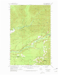
1956 Map of Salmon River
USGS Topo · Published 1980About this map
The Queets River and Clearwater River dominate this mid-century survey of the Olympic Peninsula, where deep drainages and dense river systems meet. The landscape is defined by the intersections of federal and tribal lands, spanning the Olympic National Park, Olympic National Forest, and the northern reaches of the Quinault Indian Reservation. Navigational landmarks like Rocky Rapids, Crooks Rapids, and Lyman Rapids indicate the power and character of these waterways before modern development altered the backcountry.
Find a feature on this map
52 named features on this map. Tap any name to fly to it.
Don’t see what you’re looking for? This feature index may not catch every label — zoom into the map to look around manually.
Map Details
Editions of this 1956 Salmon River Map

Other maps of this area

1921 · Quinault Lake
USGS Topo · 1:62,500

1939 · Forks
USGS Topo · 1:62,500

1939 · Mount Tom
USGS Topo · 1:62,500

1943 · Spruce Mountain
USGS Topo · 1:62,500

1943 · Copalis Beach
USGS Topo · 1:250,000

1951 · Copalis Beach
USGS Topo · 1:250,000

1955 · Taholah
USGS Topo · 1:62,500

1955 · Macafee Hill
USGS Topo · 1:62,500

1955 · Quinault Lake
USGS Topo · 1:62,500

1956 · Destruction Island
USGS Topo · 1:62,500