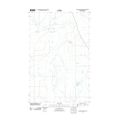
2011 Map of Salsbery Reservoir
USGS Topo · Published 2011About this map
Salsbery Reservoir and its namesake Salsbery Dam anchor this northern Montana landscape, where water management is the primary driver of development. The drainage patterns of Phillips County are clearly defined here by the East Fork Whitewater Creek and the meandering paths of Stinky Creek and its East Fork. The concentration of reservoirs with personal names—including Charley Reservoir, Louie Reservoir, and Schmittou Reservoir—suggests a history of individual landholdings and localized ranching infrastructure. A handful of larger catchments like Fjeldheim Reservoir and Big Reservoir further emphasize the importance of water storage in this semi-arid region. Apart from the isolated Forks Rd, the map reveals a sparsely populated terrain dominated by hydrologic engineering and seasonal drainage basins like Cottonwood Creek.
Find a feature on this map
14 named features on this map. Tap any name to fly to it.
Don’t see what you’re looking for? This feature index may not catch every label — zoom into the map to look around manually.
Map Details
Editions of this 2011 Salsbery Reservoir Map
This is the sole edition of this map. No revisions or reprints were ever made.
Other maps of this area

1920 · Cowan
USGS Topo · 1:125,000

1954 · Glasgow
USGS Topo · 1:250,000

1957 · Glasgow
USGS Topo · 1:250,000

1958 · Glasgow
USGS Topo · 1:250,000

1968 · Tattnall
USGS Topo · 1:24,000

1984 · Thoeny Hills East
USGS Topo · 1:24,000

1984 · Pea Lake
USGS Topo · 1:24,000

1984 · Whitewater East
USGS Topo · 1:24,000

1984 · Forks
USGS Topo · 1:24,000

1984 · Dead Horse Coulee
USGS Topo · 1:24,000