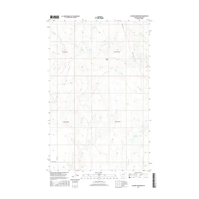
2017 Map of Salsbery Reservoir
USGS Topo · Published 2017About this map
Salsbery Reservoir and a series of smaller catchment basins define this high plains landscape in Phillips County, illustrating the critical role of water management in Montana's ranching country during the late 2010s. The drainage network is dominated by the E Fork Whitewater Cr and the descriptively named Stinky Cr, which feeds into the larger Big Reservoir. These water features, including Fieldheim Reservoir and Schmittou Reservoir, suggest a legacy of local landholding and seasonal grazing. The terrain is marked by the broad Water Coulee, while transit across this portion of the Milk River watershed is facilitated by remote corridors like Turkey Track Rd and Forks Rd. This survey documents a quiet interior of the state where the Public Land Survey System grids meet the natural contours of ephemeral creek forks and isolated coulees.
Find a feature on this map
18 named features on this map. Tap any name to fly to it.
Don’t see what you’re looking for? This feature index may not catch every label — zoom into the map to look around manually.
Map Details
Editions of this 2017 Salsbery Reservoir Map
This is the sole edition of this map. No revisions or reprints were ever made.
Other maps of this area

1920 · Cowan
USGS Topo · 1:125,000

1954 · Glasgow
USGS Topo · 1:250,000

1957 · Glasgow
USGS Topo · 1:250,000

1958 · Glasgow
USGS Topo · 1:250,000

1968 · Tattnall
USGS Topo · 1:24,000

1984 · Thoeny Hills East
USGS Topo · 1:24,000

1984 · Pea Lake
USGS Topo · 1:24,000

1984 · Whitewater East
USGS Topo · 1:24,000

1984 · Forks
USGS Topo · 1:24,000

1984 · Dead Horse Coulee
USGS Topo · 1:24,000