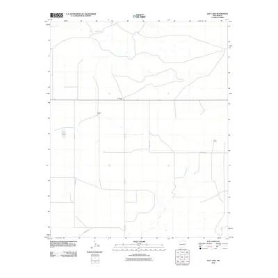
2010 Map of Salt Lake
USGS Topo · Published 2010About this map
Armstrong Ranch and Bedford Ranch center this high plains landscape in eastern New Mexico during the early 21st century. The map reveals a land defined by vast ranching tracts and intermittent water sources, where the eponymous Salt Lake sits as a primary landmark in the western portion of the quadrangle. A network of unimproved roads like County Rd-2 and County Rd-2T connect these isolated ranching operations, tracing the path of least resistance across the terrain.
Find a feature on this map
9 named features on this map. Tap any name to fly to it.
Don’t see what you’re looking for? This feature index may not catch every label — zoom into the map to look around manually.
Map Details
Editions of this 2010 Salt Lake Map
This is the sole edition of this map. No revisions or reprints were ever made.
Other maps of this area

1954 · Santa Fe
USGS Topo · 1:250,000

1954 · Fort Sumner
USGS Topo · 1:250,000

1958 · Fort Sumner
USGS Topo · 1:250,000

1958 · Santa Fe
USGS Topo · 1:250,000

1963 · Cuervo
USGS Topo · 1:24,000

1964 · Canada Colorado
USGS Topo · 1:24,000

1964 · Fallon Ranch
USGS Topo · 1:24,000

1964 · Gate Canyon
USGS Topo · 1:24,000

1964 · Newkirk
USGS Topo · 1:24,000
1964 · Salt Lake
USGS Topo · 1:24,000