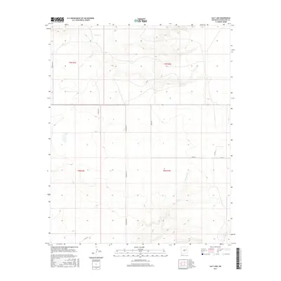
2017 Map of Salt Lake
USGS Topo · Published 2017About this map
Salt Lake sits at the heart of this high-plains landscape in Guadalupe County, serving as a primary landmark in a region defined by its vital water sources and vast ranching boundaries. This 2017 survey by the U.S. Geological Survey illustrates a traditional Western grid of township and range lines, where the land is partitioned by long section roads such as Armstrong Rd and Bedford Rd. These corridors facilitate movement across the arid terrain, connecting the drainage of Pajarito Cr in the north to the southern reaches of Arroyo Copita.
Find a feature on this map
15 named features on this map. Tap any name to fly to it.
Don’t see what you’re looking for? This feature index may not catch every label — zoom into the map to look around manually.
Map Details
Editions of this 2017 Salt Lake Map
This is the sole edition of this map. No revisions or reprints were ever made.
Other maps of this area

1954 · Santa Fe
USGS Topo · 1:250,000

1954 · Fort Sumner
USGS Topo · 1:250,000

1958 · Fort Sumner
USGS Topo · 1:250,000

1958 · Santa Fe
USGS Topo · 1:250,000

1963 · Cuervo
USGS Topo · 1:24,000

1964 · Canada Colorado
USGS Topo · 1:24,000

1964 · Fallon Ranch
USGS Topo · 1:24,000

1964 · Gate Canyon
USGS Topo · 1:24,000

1964 · Newkirk
USGS Topo · 1:24,000
1964 · Salt Lake
USGS Topo · 1:24,000