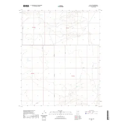
2020 Map of Salt Lake
USGS Topo · Published 2020About this map
Salt Lake and its surrounding high plains landscape define this quadrant of Guadalupe County. The geography is characterized by intermittent water systems, including the drainage of Pajarito Cr in the north and the seasonal Arroyo Copita further south. The presence of Valencia Spring suggests a critical water source for the local ranching economy in an otherwise arid environment. A grid of rural routes, such as Corriente Rd, Bedford Rd, and Armstrong Rd, provides access across the sectioned townships. These roads, along with the east-west path of Highway 156, reveal a landscape organized for utility, where land boundaries follow the Public Land Survey System across the expanses of T8N and T9N.
Find a feature on this map
16 named features on this map. Tap any name to fly to it.
Don’t see what you’re looking for? This feature index may not catch every label — zoom into the map to look around manually.
Map Details
Editions of this 2020 Salt Lake Map
This is the sole edition of this map. No revisions or reprints were ever made.
Other maps of this area

1954 · Santa Fe
USGS Topo · 1:250,000

1954 · Fort Sumner
USGS Topo · 1:250,000

1958 · Fort Sumner
USGS Topo · 1:250,000

1958 · Santa Fe
USGS Topo · 1:250,000

1963 · Cuervo
USGS Topo · 1:24,000

1964 · Canada Colorado
USGS Topo · 1:24,000

1964 · Fallon Ranch
USGS Topo · 1:24,000

1964 · Gate Canyon
USGS Topo · 1:24,000

1964 · Newkirk
USGS Topo · 1:24,000
1964 · Salt Lake
USGS Topo · 1:24,000