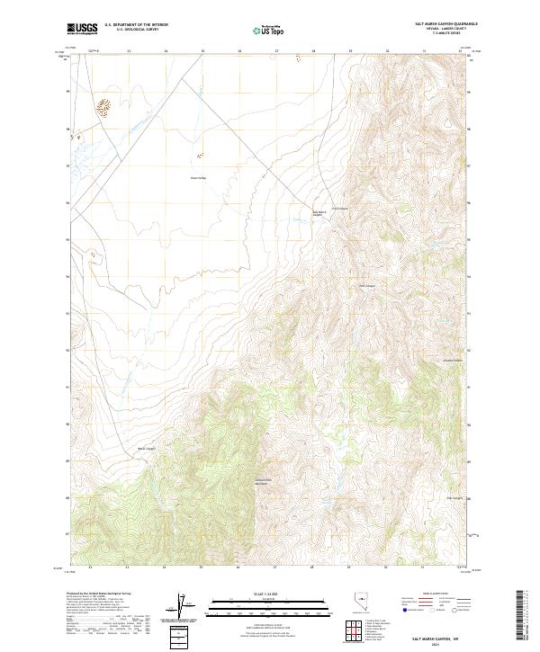
2021 Map of Salt Marsh Canyon
USGS Topo · Published 2021About this map
Simpson Park Mountains rise sharply above the southern portion of this Lander County landscape, defining the hydrology and access routes of the region. The drainage patterns are clearly marked by the paths of Callaghan Cr and Indian Cr as they flow into the broad expanse of Grass Valley to the northwest. This area is characterized by a network of seasonal water sources and canyons that have likely served as vital landmarks for ranchers and travelers in the Great Basin.
Find a feature on this map
22 named features on this map. Tap any name to fly to it.
Don’t see what you’re looking for? This feature index may not catch every label — zoom into the map to look around manually.
Map Details
Editions of this 2021 Salt Marsh Canyon Map
This is the sole edition of this map. No revisions or reprints were ever made.
Other maps of this area

1926 · Roberts Mountains
USGS Topo · 1:250,000

1929 · Roberts Mountains
USGS Topo · 1:250,000

1955 · Millett
USGS Topo · 1:250,000

1956 · Mount Callaghan
USGS Topo · 1:62,500

1956 · Walti Hot Springs
USGS Topo · 1:62,500

1956 · Hall Creek
USGS Topo · 1:62,500

1956 · Ackerman Canyon
USGS Topo · 1:62,500

1959 · Millett
USGS Topo · 1:250,000

1979 · Simpson Park Mtns
USGS Topo · 1:100,000
1986 · Fagin Mountain
USGS Topo · 1:24,000