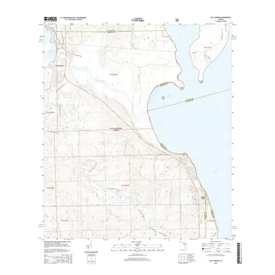
2015 Map of Salt Springs
USGS Topo · Published 2015About this map
Salt Springs serves as the primary hub within the dense wilderness of the Ocala National Forest, where spring-fed waters transition into a complex network of wetlands and prairies. The hydrology of the region is defined by the flow of Salt Springs Run as it empties into Lake George, passing Salt Springs Bar and reaching the expansive western shoreline marked by Rocky Point and Lisk Point. To the south, the landscape opens into Hopkins Prairie, a distinctive ecological feature typical of the North Florida scrub environment.
Find a feature on this map
37 named features on this map. Tap any name to fly to it.
Don’t see what you’re looking for? This feature index may not catch every label — zoom into the map to look around manually.
Map Details
Editions of this 2015 Salt Springs Map
This is the sole edition of this map. No revisions or reprints were ever made.
Other maps of this area

1954 · Daytona Beach
USGS Topo · 1:250,000

1958 · Daytona Beach
USGS Topo · 1:250,000

1964 · Daytona Beach
USGS Topo · 1:250,000

1970 · Crescent City
USGS Topo · 1:24,000

1970 · Welaka SE
USGS Topo · 1:24,000

1970 · Welaka
USGS Topo · 1:24,000
1970 · Lake Delancy
USGS Topo · 1:24,000

1970 · Salt Springs
USGS Topo · 1:24,000

1970 · Halfmoon Lake
USGS Topo · 1:24,000
1970 · Lake Kerr
USGS Topo · 1:24,000