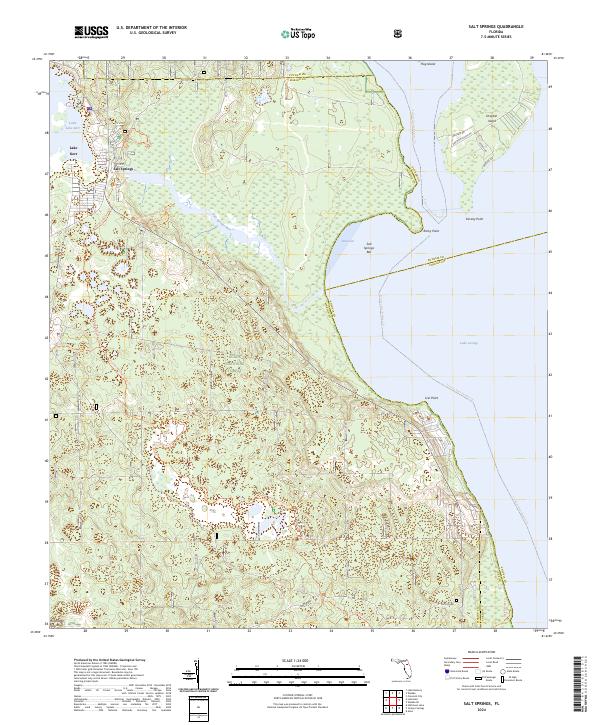
2024 Map of Salt Springs
USGS Topo · Published 2024About this map
Salt Springs serves as a central hub for this portion of the Ocala National Forest, situated between the clear waters of Lake Kerr and the sprawling expanse of Lake George. The landscape is defined by the unique hydrology of Salt Springs Run, which flows eastward into Salt Cove and the Salt Springs Bar. This 2024 survey captures a well-established network of recreation and preservation, where the Juniper Prairie Wilderness borders historic land tracts like Pats Island. The map meticulously details the transition from woodland to water, noting shoreline features such as Kinsley Point and Lisk Point, alongside modern navigational markers like the St Johns River Blueway Trl. Local infrastructure is evident through the named roads of Drayton Island and the various spur trails that provide access to the area's wildlife and springs.
Find a feature on this map
37 named features on this map. Tap any name to fly to it.
Don’t see what you’re looking for? This feature index may not catch every label — zoom into the map to look around manually.
Map Details
Editions of this 2024 Salt Springs Map
This is the sole edition of this map. No revisions or reprints were ever made.
Other maps of this area

1954 · Daytona Beach
USGS Topo · 1:250,000

1958 · Daytona Beach
USGS Topo · 1:250,000

1964 · Daytona Beach
USGS Topo · 1:250,000

1970 · Crescent City
USGS Topo · 1:24,000

1970 · Welaka SE
USGS Topo · 1:24,000

1970 · Welaka
USGS Topo · 1:24,000
1970 · Lake Delancy
USGS Topo · 1:24,000

1970 · Salt Springs
USGS Topo · 1:24,000

1970 · Halfmoon Lake
USGS Topo · 1:24,000
1970 · Lake Kerr
USGS Topo · 1:24,000