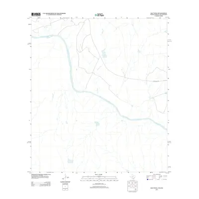
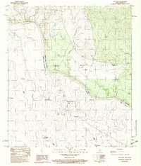
2012 Map of Salt Well
USGS Topo · Published 2012About this map
The Rio Grande forms a sweeping international boundary through this arid landscape, defining the southern border of Webb County. This 2012 survey illustrates a sparse ranching environment where water sources and limited infrastructure dictate the pattern of human presence. The ephemeral path of Borrego Cr cuts through the terrain, eventually feeding toward the river valley, while the named location of Salt Well stands as a notable landmark in a region otherwise characterized by expansive open range. Connectivity in this borderlands area is maintained by Ranch Road 1021, which serves as the primary artery for local transit through the scrubland. This map is essential for understanding the modern layout of the Texas-Mexico border, showcasing the intersection of natural river morphology and the rural road networks that support local agriculture and border management.
Find a feature on this map
4 named features on this map. Tap any name to fly to it.
Don’t see what you’re looking for? This feature index may not catch every label — zoom into the map to look around manually.
Map Details
Editions of this 2012 Salt Well Map
This is the sole edition of this map. No revisions or reprints were ever made.
Other maps of this area

1940 · Chupadera
USGS Topo · 1:62,500

1941 · Botella Creek
USGS Topo · 1:62,500

1957 · Indio Creek
USGS Topo · 1:62,500

1957 · Botella Creek
USGS Topo · 1:62,500

1958 · Eagle Pass
USGS Topo · 1:250,000

1965 · Eagle Pass
USGS Topo · 1:250,000
1982 · Tovar Creek East
USGS Topo · 1:24,000
1982 · San Pedro Creek
USGS Topo · 1:24,000
1983 · Tovar Creek West
USGS Topo · 1:24,000
1983 · Salt Well
USGS Topo · 1:24,000