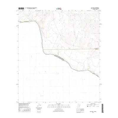
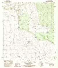
2016 Map of Salt Well
USGS Topo · Published 2016About this map
The Rio Grande serves as the dominant geographic and political spine of this borderland, defining the international boundary between the United States of America and Mexico. This reach of the river in South Texas shows a landscape of intermittent drainage and sparsely developed ranchland, where water management is central to the area's utility. The namesake Salt Well settlement sits near the eastern edge, connected to the wider region by the winding path of FM 1021. The terrain is shaped by several seasonal waterways, including the meandering Borrego Cr, which flows toward the river through the dry brush country. Surveyed just after the middle of the decade, the map illustrates the crossing of county lines between Maverick and Webb counties, highlighting a remote section of the Rio Grande valley where traditional land boundaries meet the modern transportation network.
Find a feature on this map
8 named features on this map. Tap any name to fly to it.
Don’t see what you’re looking for? This feature index may not catch every label — zoom into the map to look around manually.
Map Details
Editions of this 2016 Salt Well Map
This is the sole edition of this map. No revisions or reprints were ever made.
Other maps of this area

1940 · Chupadera
USGS Topo · 1:62,500

1941 · Botella Creek
USGS Topo · 1:62,500

1957 · Indio Creek
USGS Topo · 1:62,500

1957 · Botella Creek
USGS Topo · 1:62,500

1958 · Eagle Pass
USGS Topo · 1:250,000

1965 · Eagle Pass
USGS Topo · 1:250,000
1982 · Tovar Creek East
USGS Topo · 1:24,000
1982 · San Pedro Creek
USGS Topo · 1:24,000
1983 · Tovar Creek West
USGS Topo · 1:24,000
1983 · Salt Well
USGS Topo · 1:24,000