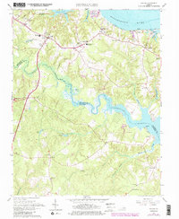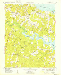
1949 Map of Saluda
USGS Topo · Published 1949About this map
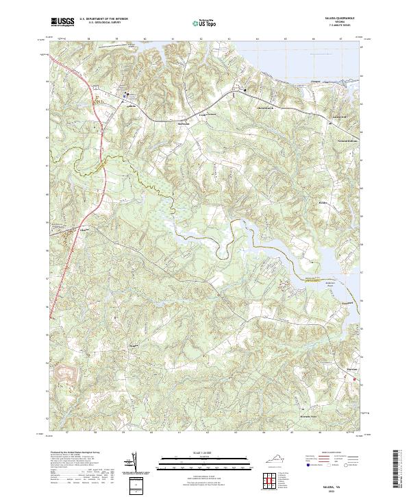
The Tidewater region of Virginia, specifically the boundary between Middlesex and Gloucester counties, is defined by its intricate network of coastal inlets and expansive swamps. Saluda serves as a central hub, connected to outlying settlements like Cooks Corner and Glenns via the Tidewater Trail and the George Washington Memorial Highway. The landscape is dominated by the broad Rappahannock River to the north and the winding Piankatank River to the south, with the massive Dragon Swamp threading between them. This era reveals a community deeply rooted in its local institutions, from the Saluda High Sch and Middlesex Co Training Sch to numerous historic congregations such as Christ Ch and Immanuel Ch. Riverside commerce is evidenced by Burhans Wharf on the Rappahannock and fishing activities near Freeport on the Piankatank.
Find a feature on this map
52 named features on this map. Tap any name to fly to it.
Don’t see what you’re looking for? This feature index may not catch every label — zoom into the map to look around manually.
Map Details
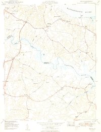
Editions of this 1949 Saluda Map
2 editions found
Historical Maps of Saluda Through Time
7 maps found