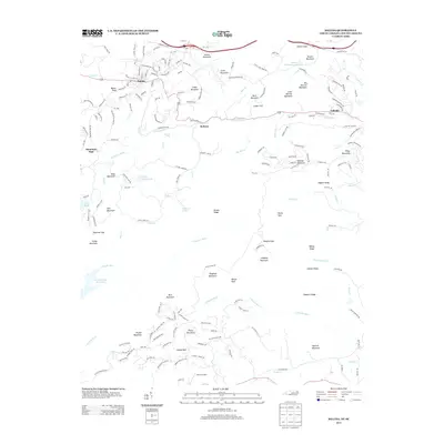
2013 Map of Saluda
USGS Topo · Published 2013About this map
Saluda sits at the northern edge of this high-elevation landscape, where the Blue Ridge Escarpment creates a dramatic transition between the Carolinas. This 2013 survey illustrates the complex topography of the Saluda Mountains, defined by the winding course of the N Pacolet River and its descent past Pearsons Falls. The map reveals a cluster of settlements including Melrose and Valhalla, linked by historic routes like Howard Gap Rd.
Find a feature on this map
187 named features on this map. Tap any name to fly to it.
Don’t see what you’re looking for? This feature index may not catch every label — zoom into the map to look around manually.
Map Details
Editions of this 2013 Saluda Map
This is the sole edition of this map. No revisions or reprints were ever made.
Other maps of this area

1907 · Saluda
USGS Topo · 1:125,000

1935 · Hendersonville
USGS Topo · 1:24,000

1935 · Fishtop
USGS Topo · 1:24,000

1935 · Zirconia
USGS Topo · 1:24,000

1946 · Zirconia
USGS Topo · 1:24,000
1946 · Hendersonville
USGS Topo · 1:24,000

1946 · Cliffield Mtn
USGS Topo · 1:24,000
1947 · Hendersonville
USGS Topo · 1:24,000
1947 · Zirconia
USGS Topo · 1:24,000

1947 · Cliffield Mtn.
USGS Topo · 1:24,000