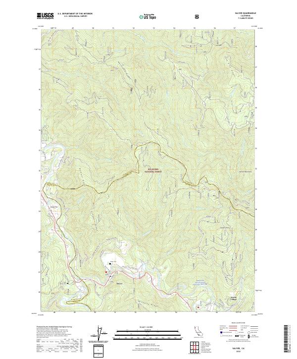
2022 Map of Salyer
USGS Topo · Published 2022About this map
Salyer and the adjacent community of Trinity Village sit at the confluence of rugged mountain ridges and the winding river systems of the Klamath Mountains. The landscape is defined by the Trinity Wild and Scenic River and the South Fork Trinity River, which carve through the Six Rivers National Forest. This modern survey illustrates the steep elevation changes across Waterman Ridge, Campbell Ridge, and the Salmon Mountains, reaching toward the Groves Prairie in the east. Genealogy and local history researchers can identify specific burial sites such as the Salyer Cem and Friday Ridge Cem, along with older settlement names like China Flat. The map also details a network of forest routes, including Campbell Ridge Road and Friday Ridge Rd, that provide access to high-elevation landmarks like Zeigler Point and Hennessy Ridge.
Find a feature on this map
54 named features on this map. Tap any name to fly to it.
Don’t see what you’re looking for? This feature index may not catch every label — zoom into the map to look around manually.
Map Details
Editions of this 2022 Salyer Map
This is the sole edition of this map. No revisions or reprints were ever made.
Other maps of this area

1909 · Big Bar
USGS Topo · 1:96,000

1915 · Big Bar and Vicinity
USGS Topo · 1:250,000

1922 · China Flat
USGS Topo · 1:62,500

1925 · Hoopa
USGS Topo · 1:125,000

1948 · Weed
USGS Topo · 1:250,000

1950 · Weed
USGS Topo · 1:250,000

1951 · Ironside Mountain
USGS Topo · 1:62,500

1952 · Willow Creek
USGS Topo · 1:62,500

1952 · Hoopa
USGS Topo · 1:62,500

1955 · Salmon Mtn
USGS Topo · 1:62,500