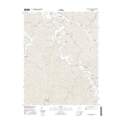
2016 Map of Salyersville South
USGS Topo · Published 2016About this map
Salyersville anchors the northern edge of this terrain, where the Mountain Pkwy intersects with local routes leading into the winding hollows of Magoffin County. The landscape is defined by the tight, dendritic drainage patterns of the Licking River and its numerous tributaries, such as Burning Fork and Right Oakley Creek. Small communities like Royalton, Sublett, and Swampton are situated along these valley floors, reflecting a long-standing settlement pattern where homes and roads are constrained by the steep ridges. Distinctive landforms like Big Half Mtn and Little Half Mtn rise above the river bends, including the aptly named Bend of the River. To the south, the boundary with Breathitt County marks the transition into even more isolated territory, accessible only by winding roads like Carver Rd.
Find a feature on this map
61 named features on this map. Tap any name to fly to it.
Don’t see what you’re looking for? This feature index may not catch every label — zoom into the map to look around manually.
Map Details
Editions of this 2016 Salyersville South Map
This is the sole edition of this map. No revisions or reprints were ever made.
Other maps of this area

1886 · Prestonsburg
USGS Topo · 1:125,000

1889 · Salyersville
USGS Topo · 1:125,000

1891 · Salyersville
USGS Topo · 1:125,000

1892 · Prestonsburg
USGS Topo · 1:125,000

1899 · Salyersville
USGS Topo · 1:125,000

1915 · Paintsville
USGS Topo · 1:48,000

1915 · Prestonsburg
USGS Topo · 1:62,500

1917 · Paintsville
USGS Topo · 1:62,500

1918 · Prestonsburg
USGS Topo · 1:62,500

1951 · Tiptop
USGS Topo · 1:24,000