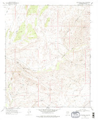
1969 Map of Sam Powell Peak
USGS Topo · Published 1979About this map
Sam Powell Peak and the surrounding high desert of Yavapai County define this 1960s landscape, where mining activity and rugged drainage systems intersect. The Hassayampa River cuts through the center of the sheet, joined by seasonal flows from Fools Canyon and Solomon Gulch. This era of the Arizona interior shows a heavy concentration of mineral exploration and extraction, particularly in the Black Hills where the Black Hills Mines and the Mistake Mine are located. Further south, the Oro Grande Mine sits near the Rincon Road. The map documents a network of primitive transportation essential to these operations, from the established Constellation Road to numerous unnamed Jeep Trails and Pack Trails that provided access to isolated prospects and landmarks like The Needle. Small-scale industrial sites, including a Sand Mill and a Gaging Station, further illustrate the working nature of the terrain.
Find a feature on this map
27 named features on this map. Tap any name to fly to it.
Don’t see what you’re looking for? This feature index may not catch every label — zoom into the map to look around manually.
Map Details
Editions of this 1969 Sam Powell Peak Map
3 editions found
Other maps of this area

1887 · Prescott
USGS Topo · 1:250,000

1892 · Prescott
USGS Topo · 1:250,000

1903 · Congress
USGS Topo · 1:125,000

1904 · Congress
USGS Topo · 1:125,000

1947 · Wagoner
USGS Topo · 1:62,500

1948 · Wagoner
USGS Topo · 1:63,360

1950 · Wagoner
USGS Topo · 1:62,500

1950 · Prescott
USGS Topo · 1:250,000

1954 · Prescott
USGS Topo · 1:250,000

1954 · Phoenix
USGS Topo · 1:250,000