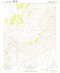
1969 Map of Sam Powell Peak
USGS Topo · Published 1979About this map
Oro Grande Mine and the Mistake Mine sit amidst the arid terrain of the Black Hills in this 1969 field-checked survey of central Arizona. The landscape is defined by the winding course of the Hassayampa River, which cuts through the southern portion of the quadrangle near the Wickenburg Mts. This area, heavily marked by mining activity, includes specialized structures like the Sand Mill and numerous unnamed prospect pits and shafts. Transportation in this era relied heavily on a network of primitive routes, including the Rincon Road, various jeep trails, and a pack trail weaving through Box Canyon. Distinctive landmarks such as The Needle and Sam Powell Peak serve as prominent navigational aids for those traversing the canyons and gulches, while the presence of a Gaging Station on the river indicates the importance of water management in this desert environment.
Find a feature on this map
28 named features on this map. Tap any name to fly to it.
Don’t see what you’re looking for? This feature index may not catch every label — zoom into the map to look around manually.
Map Details
Editions of this 1969 Sam Powell Peak Map
3 editions found
Other maps of this area

1887 · Prescott
USGS Topo · 1:250,000

1892 · Prescott
USGS Topo · 1:250,000

1903 · Congress
USGS Topo · 1:125,000

1904 · Congress
USGS Topo · 1:125,000

1947 · Wagoner
USGS Topo · 1:62,500

1948 · Wagoner
USGS Topo · 1:63,360

1950 · Wagoner
USGS Topo · 1:62,500

1950 · Prescott
USGS Topo · 1:250,000

1954 · Prescott
USGS Topo · 1:250,000

1954 · Phoenix
USGS Topo · 1:250,000