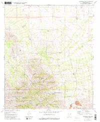
1981 Map of Samaniego Peak
USGS Topo · Published 1981About this map
Samaniego Peak rises as the central landmark of the Sierrita Mountains in this early 1980s topography. The landscape is defined by its deep canyons and drainages, including Fresnal Canyon and Mc Gee Wash, which provide a contrast to the high-elevation peaks like Gunsight Mtn and Keystone Peak. Human presence is concentrated around Mc Gees Settlement and the small enclave of Demetrie to the southeast.
Find a feature on this map
48 named features on this map. Tap any name to fly to it.
Don’t see what you’re looking for? This feature index may not catch every label — zoom into the map to look around manually.
Map Details
Editions of this 1981 Samaniego Peak Map
2 editions found
Other maps of this area

1920 · Arivaca
USGS Topo · 1:125,000

1925 · Samaniego Peak
USGS Topo · 1:62,500

1925 · San Xavier
USGS Topo · 1:62,500

1934 · Tucson Mountains
USGS Topo · 1:125,000

1939 · Twin Buttes
USGS Topo · 1:62,500

1940 · Palo Alto Ranch
USGS Topo · 1:62,500

1941 · Twin Buttes
USGS Topo · 1:62,500

1941 · Cocoraque Butte
USGS Topo · 1:62,500

1943 · Cocoraque Butte
USGS Topo · 1:62,500

1943 · Palo Alto Ranch
USGS Topo · 1:62,500