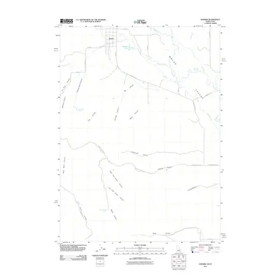
2011 Map of Samaria
USGS Topo · Published 2011About this map
Samaria serves as the primary settlement hub on this Idaho-Utah border sheet, situated at the head of the Malad Valley. The landscape is defined by its sophisticated water management, including the Samaria Lake Canal and the natural drainage of the Malad River and Little Malad River. Numerous family-named landmarks suggest a deep agricultural and ranching heritage, with Thomas Davis Springs and Gibbs Spring providing essential water sources in a region deeply carved by canyons. To the west and south, the terrain becomes increasingly complex with features like Henderson Canyon, Gardner Canyon, and the distinct Right Fork and Left Fork Brush Canyons. The road network, including S Samaria Rd and Gardner Canyon Rd, follows the natural contours of the valley floor and canyon mouths.
Find a feature on this map
38 named features on this map. Tap any name to fly to it.
Don’t see what you’re looking for? This feature index may not catch every label — zoom into the map to look around manually.
Map Details
Editions of this 2011 Samaria Map
This is the sole edition of this map. No revisions or reprints were ever made.
Other maps of this area

1954 · Pocatello
USGS Topo · 1:250,000

1954 · Brigham City
USGS Topo · 1:250,000

1958 · Pocatello
USGS Topo · 1:250,000

1958 · Brigham City
USGS Topo · 1:250,000

1962 · Brigham City
USGS Topo · 1:250,000
1964 · Portage
USGS Topo · 1:24,000

1968 · Ireland Springs
USGS Topo · 1:24,000

1968 · Grover Canyon
USGS Topo · 1:24,000

1968 · Samaria
USGS Topo · 1:24,000

1968 · Malad City West
USGS Topo · 1:24,000