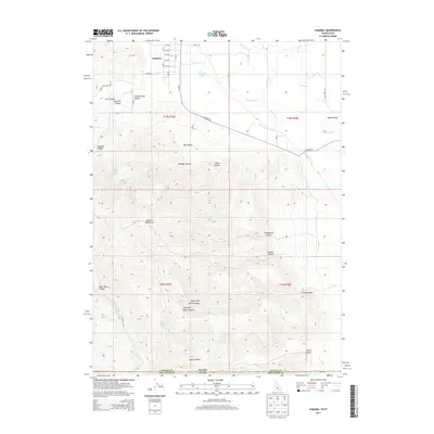
2013 Map of Samaria
USGS Topo · Published 2013About this map
Samaria serves as the primary settlement on this Idaho-Utah borderlands survey, situated where the northern slopes of the Samaria Mountains meet the Malad Valley. The landscape is defined by its sophisticated water management systems, including the Samaria Lake Canal and Samaria Lake, which capture runoff from the high ridges to sustain the agricultural flats below. The terrain is deeply incised by numerous canyons, such as Henderson Canyon and Gardner Canyon, which drain into the Malad River as it flows southward.
Find a feature on this map
41 named features on this map. Tap any name to fly to it.
Don’t see what you’re looking for? This feature index may not catch every label — zoom into the map to look around manually.
Map Details
Editions of this 2013 Samaria Map
This is the sole edition of this map. No revisions or reprints were ever made.
Other maps of this area

1954 · Pocatello
USGS Topo · 1:250,000

1954 · Brigham City
USGS Topo · 1:250,000

1958 · Pocatello
USGS Topo · 1:250,000

1958 · Brigham City
USGS Topo · 1:250,000

1962 · Brigham City
USGS Topo · 1:250,000
1964 · Portage
USGS Topo · 1:24,000

1968 · Ireland Springs
USGS Topo · 1:24,000

1968 · Grover Canyon
USGS Topo · 1:24,000

1968 · Samaria
USGS Topo · 1:24,000

1968 · Malad City West
USGS Topo · 1:24,000