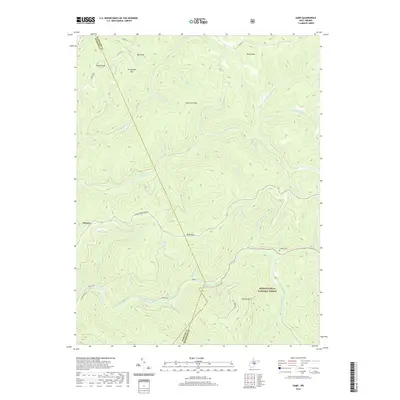
2019 Map of Samp
USGS Topo · Published 2019About this map
The high ridges of Point Mountain Rd divide the watersheds of Randolph and Webster counties in this detailed 2019 survey. The terrain is defined by the deep incisions of the Back Fork Elk River and the Elk River, which converge near the settlement of Samp. This high-altitude landscape is characterized by a dense network of mountain runs, including Hull Camp Run, Rough Run, and Hickorylick Run, reflecting the complex drainage patterns of the Monongahela National Forest.
Find a feature on this map
45 named features on this map. Tap any name to fly to it.
Don’t see what you’re looking for? This feature index may not catch every label — zoom into the map to look around manually.
Map Details
Editions of this 2019 Samp Map
This is the sole edition of this map. No revisions or reprints were ever made.
Other maps of this area

1891 · Huntersville
USGS Topo · 1:125,000

1893 · Buckhannon
USGS Topo · 1:125,000

1894 · Huntersville
USGS Topo · 1:125,000

1896 · Buckhannon
USGS Topo · 1:125,000

1897 · Buckhannon
USGS Topo · 1:125,000

1913 · Hacker Valley
USGS Topo · 1:48,000

1913 · Pickens
USGS Topo · 1:48,000

1915 · Webster Springs
USGS Topo · 1:48,000

1915 · Hacker Valley
USGS Topo · 1:62,500

1915 · Pickens
USGS Topo · 1:62,500