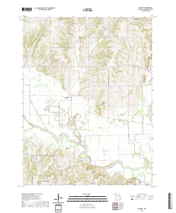
2021 Map of Sampsel
USGS Topo · Published 2021About this map
The Grand River snakes across the southern reaches of this Livingston County landscape, joined by its major tributary, the Thompson River, in the southeast corner. This riverine environment is defined by broad floodplains and a network of named drainages like Penitentiary Br, Hog Branch, and Lake Cr that carve through the surrounding uplands. The distribution of settlements such as Sampsel, Mooresville, and Springhill reveals a rural pattern of small hubs connected by a dense grid of local roads, including Liv 516 and Liv 538. Genealogists and local historians will find the Mooresville Cem and Mount Pleasant Cem clearly marked among the ridges. The terrain rises to a localized high point at Shale Hill near Utica, illustrating the transition from bottomlands to the rolling heights that characterize north-central Missouri.
Find a feature on this map
56 named features on this map. Tap any name to fly to it.
Don’t see what you’re looking for? This feature index may not catch every label — zoom into the map to look around manually.
Map Details
Editions of this 2021 Sampsel Map
This is the sole edition of this map. No revisions or reprints were ever made.
Other maps of this area

1921 · Chillicothe
USGS Topo · 1:62,500

1922 · Gallatin
USGS Topo · 1:62,500

1923 · Chillicothe
USGS Topo · 1:62,500

1924 · Dawn
USGS Topo · 1:62,500

1924 · Braymer
USGS Topo · 1:62,500

1951 · Utica
USGS Topo · 1:62,500

1953 · Moberly
USGS Topo · 1:250,000

1954 · Moberly
USGS Topo · 1:250,000

1957 · Moberly
USGS Topo · 1:250,000

1960 · Moberly
USGS Topo · 1:250,000