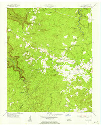
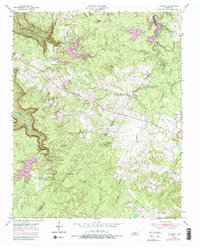
1954 Map of Sampson
USGS Topo · Published 1955About this map
The dramatic gorge and plateau topography of the Cumberland Plateau defines this mid-century survey of the Van Buren and Bledsoe county line. The landscape is dominated by the steep incisions of Cane Creek and its tributaries, including the namesake Falls Creek Falls. Much of the southern territory is preserved within Falls Creek Falls State Park, featuring the Falls Creek Falls Scout Camp and several prominent overlooks.
Find a feature on this map
42 named features on this map. Tap any name to fly to it.
Don’t see what you’re looking for? This feature index may not catch every label — zoom into the map to look around manually.
Map Details
Editions of this 1954 Sampson Map
5 editions found
Other maps of this area

1892 · Pikeville
USGS Topo · 1:125,000

1895 · Pikeville
USGS Topo · 1:125,000

1909 · Sequatchie Valley
USGS Topo · 1:62,500

1910 · Pikeville
USGS Topo · 1:62,500

1912 · Crossville
USGS Topo · 1:62,500

1935 · Brockdell
USGS Topo · 1:24,000

1935 · Billingsley Gap
USGS Topo · 1:24,000
1935 · Pikeville
USGS Topo · 1:24,000

1935 · Smart Mountain
USGS Topo · 1:24,000

1943 · Cookeville
USGS Topo · 1:100,000