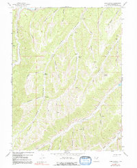
1962 Map of Sams Canyon
USGS Topo · Published 1992About this map
The Strawberry River flows along the northern edge of this high-altitude landscape in Duchesne County, where a complex network of canyons and hollows defines the terrain. Recorded through field checks in the early 1960s, the map reveals a remote area marked primarily by its geological features and early resource extraction. The northeastern corner contains evidence of local mining history with the Frank Mine and Payne Mine, both situated near Bowen Canyon. Extensive trail networks and 4WD tracks thread through Sams Canyon and its many tributaries, such as Dipping Vat Hollow and Raspberry Hollow. Named water sources like Driscoll Spring and Wildhorse Spring appear as vital landmarks in this arid, high-country environment, providing a sense of the logistical challenges faced by early travelers and miners in the region.
Find a feature on this map
36 named features on this map. Tap any name to fly to it.
Don’t see what you’re looking for? This feature index may not catch every label — zoom into the map to look around manually.
Map Details
Editions of this 1962 Sams Canyon Map
3 editions found
Other maps of this area

1885 · Uinta
USGS Topo · 1:250,000

1886 · Price River
USGS Topo · 1:250,000

1896 · Price River
USGS Topo · 1:250,000

1954 · Salt Lake City
USGS Topo · 1:250,000

1956 · Price
USGS Topo · 1:250,000

1958 · Salt Lake City
USGS Topo · 1:250,000

1960 · Salt Lake City
USGS Topo · 1:250,000

1960 · Price
USGS Topo · 1:250,000

1962 · Price
USGS Topo · 1:250,000

1962 · Strawberry Pinnacles
USGS Topo · 1:24,000