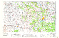
1954 Map of San Angelo
USGS Topo · Published 1979About this map
San Angelo serves as the regional hub in this West Texas survey, where the confluence of the North Concho River, Middle Concho River, and South Concho River defines the local geography. The map captures the significant water management infrastructure of the Concho Valley, including Twin Buttes Res, Lake Nasworthy, and the EV Spence Reservoir along the Colorado River. The landscape transitions from the river valleys to the high mesas and peaks of the Edwards Plateau, marked by landmarks like Goat Mountain and Nipple Peak. Transportation networks of the Santa Fe RR link dispersed ranching and oil-producing outposts such as Texon, Santa Rita, and Best. Small community centers like Knickerbocker and Saint Lawrence provide a view into the rural settlement patterns and local lineage of Tom Green County and its neighbors during the late 1970s.
Find a feature on this map
85 named features on this map. Tap any name to fly to it.
Don’t see what you’re looking for? This feature index may not catch every label — zoom into the map to look around manually.
Map Details
Editions of this 1954 San Angelo Map
2 editions found

Other maps of this area

1890 · Abilene
USGS Topo · 1:125,000

1891 · Hayrick
USGS Topo · 1:125,000

1892 · San Angelo
USGS Topo · 1:125,000

1892 · Eden
USGS Topo · 1:125,000

1892 · Abilene
USGS Topo · 1:125,000

1892 · Ballinger
USGS Topo · 1:125,000

1893 · Fort McKavett
USGS Topo · 1:125,000

1893 · Sweetwater
USGS Topo · 1:125,000

1894 · Hayrick
USGS Topo · 1:125,000

1895 · Sherwood
USGS Topo · 1:125,000