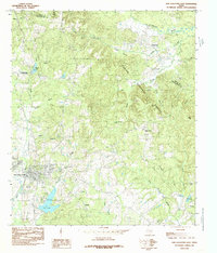
San Augustine serves as the focal point for this East Texas landscape, where the town's expansion meets the dense woodlands of the Sabine National Forest. The map documents a complex drainage system defined by Ayish Bayou and Palo Gaucho Bayou, which carve through the terrain alongside numerous named tributaries like Ghost Branch and Frizelle Branch. The presence of small settlements and place names such as Calgary, Hawthorne, and Black Ankle reflects the deep-rooted local history and rural character of the region during the early 1980s. Water management and recreation are evident in the development of City Lake, while more isolated features like Lilly Lake and Bland Lake dot the forested areas. The boundary between Shelby and San Augustine Counties runs across the northern portion of the map, illustrating the administrative divisions of this timber-rich region.
31 named features on this map. Tap any name to fly to it.
Don’t see what you’re looking for? This feature index may not catch every label — zoom into the map to look around manually.
This is the sole edition of this map. No revisions or reprints were ever made.
68 maps found

1958 Bronson
San Augustine County, TX

1958 Mc Gee Bend
San Augustine County, TX

1984 Bronson
San Augustine County, TX

1984 Buck Bay
San Augustine County, TX

1984 Chinquapin
San Augustine County, TX

1984 Chireno North
San Augustine County, TX

1984 Chireno South
San Augustine County, TX

1984 Harvey Creek
San Augustine County, TX

1984 Norwood
San Augustine County, TX

1984 San Augustine East
San Augustine County, TX

1984 San Augustine West
San Augustine County, TX

1984 Veach
San Augustine County, TX

2003 Buck Bay
San Augustine County, TX

2003 Chireno South
San Augustine County, TX

2003 Harvey Creek
San Augustine County, TX

2003 Norwood
San Augustine County, TX

2003 San Augustine East
San Augustine County, TX

2003 Veach
San Augustine County, TX
2010 Bronson
San Augustine County, TX
2010 Buck Bay
San Augustine County, TX
2010 Chinquapin
San Augustine County, TX
2010 Chireno North
San Augustine County, TX
2010 Chireno South
San Augustine County, TX
2010 Harvey Creek
San Augustine County, TX
2010 Norwood
San Augustine County, TX
2010 San Augustine East
San Augustine County, TX
2010 San Augustine West
San Augustine County, TX
2011 Veach
San Augustine County, TX
2013 Bronson
San Augustine County, TX
2013 Buck Bay
San Augustine County, TX
2013 Chinquapin
San Augustine County, TX
2013 Chireno North
San Augustine County, TX
2013 Chireno South
San Augustine County, TX
2013 Harvey Creek
San Augustine County, TX
2013 Norwood
San Augustine County, TX
2013 San Augustine East
San Augustine County, TX
2013 San Augustine West
San Augustine County, TX
2013 Veach
San Augustine County, TX
2016 Bronson
San Augustine County, TX
2016 Buck Bay
San Augustine County, TX
2016 Chinquapin
San Augustine County, TX
2016 Chireno North
San Augustine County, TX
2016 Chireno South
San Augustine County, TX
2016 Harvey Creek
San Augustine County, TX
2016 Norwood
San Augustine County, TX
2016 San Augustine East
San Augustine County, TX
2016 San Augustine West
San Augustine County, TX
2016 Veach
San Augustine County, TX
2019 Bronson
San Augustine County, TX
2019 Buck Bay
San Augustine County, TX
2019 Chinquapin
San Augustine County, TX
2019 Chireno North
San Augustine County, TX
2019 Chireno South
San Augustine County, TX
2019 Harvey Creek
San Augustine County, TX
2019 Norwood
San Augustine County, TX
2019 San Augustine East
San Augustine County, TX
2019 San Augustine West
San Augustine County, TX
2019 Veach
San Augustine County, TX

2022 Bronson
San Augustine County, TX

2022 Buck Bay
San Augustine County, TX

2022 Chinquapin
San Augustine County, TX

2022 Chireno North
San Augustine County, TX

2022 Chireno South
San Augustine County, TX

2022 Harvey Creek
San Augustine County, TX

2022 Norwood
San Augustine County, TX

2022 San Augustine East
San Augustine County, TX

2022 San Augustine West
San Augustine County, TX

2022 Veach
San Augustine County, TX









