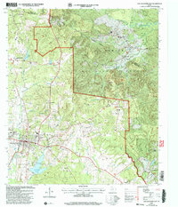
2003 Map of San Augustine East
USGS Topo · Published 2004About this map
San Augustine anchors the southwestern portion of this East Texas terrain, where the managed timberlands of the Sabine National Forest dominate the eastern landscape. The area is defined by a dense network of watercourses, including Ayish Bayou and Palo Gacho Creek, which have historically shaped the settlement patterns of San Augustine County. Local genealogists will find a wealth of family history landmarks, from the Whitton Cem in the north to the Chumley Cem and Pickard Cem in the south. The map reflects a rural community rooted in small settlements like White Rock, Hawthorne, and Sunrise, alongside infrastructure such as the San Augustine City Lake and its associated Boat Ramp. This survey provides a clear view of the interface between urban growth and protected forest lands at the start of the 21st century.
Find a feature on this map
53 named features on this map. Tap any name to fly to it.
Don’t see what you’re looking for? This feature index may not catch every label — zoom into the map to look around manually.
Map Details
Editions of this 2003 San Augustine East Map
This is the sole edition of this map. No revisions or reprints were ever made.
Other maps of this area

1944 · Patroon
USGS Topo · 1:62,500

1953 · Alexandria
USGS Topo · 1:250,000

1953 · Palestine
USGS Topo · 1:250,000

1955 · Alexandria
USGS Topo · 1:250,000

1956 · Patroon
USGS Topo · 1:62,500

1957 · Palestine
USGS Topo · 1:250,000

1958 · Hemphill
USGS Topo · 1:62,500

1958 · San Augustine
USGS Topo · 1:62,500

1958 · Bronson
USGS Topo · 1:62,500

1984 · Norwood
USGS Topo · 1:24,000