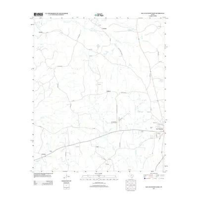
2013 Map of San Augustine West
USGS Topo · Published 2013About this map
San Augustine anchors the southeastern corner of this East Texas survey, where the town's grid meets local landmarks like the Garrett Cem and Moses Cem. Moving westward, the landscape transitions into a series of rural communities including Union, Redland, and Denning, connected by a network of farm roads and county routes. The area is defined by its numerous small burial grounds, such as Holt Cem, Lewis Cem, and Sanders Cem, which serve as vital markers for local genealogy and historical settlement patterns.
Find a feature on this map
62 named features on this map. Tap any name to fly to it.
Don’t see what you’re looking for? This feature index may not catch every label — zoom into the map to look around manually.
Map Details
Editions of this 2013 San Augustine West Map
This is the sole edition of this map. No revisions or reprints were ever made.
Other maps of this area

1953 · Palestine
USGS Topo · 1:250,000

1957 · Palestine
USGS Topo · 1:250,000

1958 · Broaddus
USGS Topo · 1:62,500

1958 · San Augustine
USGS Topo · 1:62,500

1958 · Martinsville
USGS Topo · 1:62,500

1958 · Bronson
USGS Topo · 1:62,500

1984 · Norwood
USGS Topo · 1:24,000
1984 · Chireno South
USGS Topo · 1:24,000
1984 · Chinquapin
USGS Topo · 1:24,000

1984 · Palestine
USGS Topo · 1:250,000