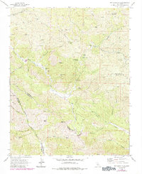
1969 Map of San Benito Mtn
USGS Topo · Published 1984About this map
Mining operations and remote homesteads define this rugged corner of the Diablo Range where San Benito, Monterey, and Fresno counties meet. The landscape is heavily marked by the region's mercury and asbestos extraction history, featuring notable sites such as the Alpine Mine, St Thomas Mine, and the San Benito Mill Site near the headwaters of the San Benito River. A network of jeep trails and historic routes like the Sawmill Trail connect these industrial outposts to small settlements and camps like Lewis Flat and Roach.
Find a feature on this map
49 named features on this map. Tap any name to fly to it.
Don’t see what you’re looking for? This feature index may not catch every label — zoom into the map to look around manually.
Map Details
Editions of this 1969 San Benito Mtn Map
3 editions found
Other maps of this area

1915 · Priest Valley
USGS Topo · 1:125,000

1941 · Priest Valley
USGS Topo · 1:62,500

1941 · San Ardo
USGS Topo · 1:62,500

1943 · New Idria
USGS Topo · 1:62,500

1943 · San Ardo
USGS Topo · 1:62,500

1943 · Hernandez Valley
USGS Topo · 1:62,500

1944 · Hernandez Valley
USGS Topo · 1:62,500

1944 · Priest Valley
USGS Topo · 1:62,500

1948 · Santa Cruz
USGS Topo · 1:250,000

1955 · Santa Cruz
USGS Topo · 1:250,000