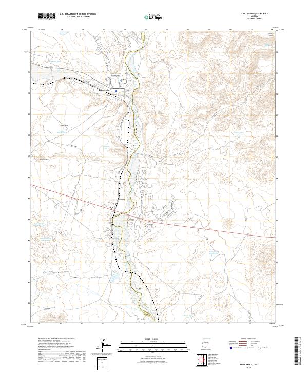
2021 Map of San Carlos
USGS Topo · Published 2021About this map
San Carlos serves as the primary hub of activity in this 2021 survey, situated near the confluence of Gilson Wash and the San Carlos River. The landscape is defined by its arid terrain and essential water management features, including the Gila Community College San Carlos Campus and a network of livestock tanks such as Maltazan Tank and Telephone Tank. To the east, the elevation rises toward Antelope Flats and Triplets Rd, while the western portion is dominated by the prominent volcanic landforms of Peridot Mesa and Peridot Hill. This map illustrates the modern road network on tribal lands, including Kitcheyan Rd and Peridot Siding Rd, which trace the valley floor alongside the winding riverbed. The distribution of tanks like Hollywood Bowl Tank and Sawmill Tank Number One underscores the critical role of water infrastructure in managing the surrounding open range and rugged highlands.
Find a feature on this map
49 named features on this map. Tap any name to fly to it.
Don’t see what you’re looking for? This feature index may not catch every label — zoom into the map to look around manually.
Map Details
Editions of this 2021 San Carlos Map
This is the sole edition of this map. No revisions or reprints were ever made.
Other maps of this area

1915 · Christmas
USGS Topo · 1:62,500

1917 · Christmas
USGS Topo · 1:62,500

1954 · Mesa
USGS Topo · 1:250,000

1957 · Mesa
USGS Topo · 1:250,000

1958 · Mesa
USGS Topo · 1:250,000

1960 · Mesa
USGS Topo · 1:250,000

1962 · San Carlos Reservoir
USGS Topo · 1:62,500

1964 · Mesa
USGS Topo · 1:250,000

1965 · Sontag Mesa
USGS Topo · 1:24,000

1965 · Bucket Mtn
USGS Topo · 1:24,000